Nine sites in twenty minutes. How we picked a development site in less than half an hour
You've got nine potential sites for your next residential development, and twenty minutes to pick the best one. Where do you start?
If you're an architect, a property developer, or a city planner, this may be a familiar scenario. Project turnarounds are quick, access to proper 3D data is limited, and it's hard to narrow down the right site. A plot might look perfect on paper but without seeing it in 3D, you can't really know if you'll be hindered by terrain changes, existing vegetation, or limited to fitting in with neighbouring low rise buildings.
So we set ourselves a challenge to evaluate nine sites across Seattle and San Francisco using Cityweft and SketchUp, and narrow them down to one or two contenders for a residential project with around 100,000m² of floor area. Here's how it went.
The Process, Timed
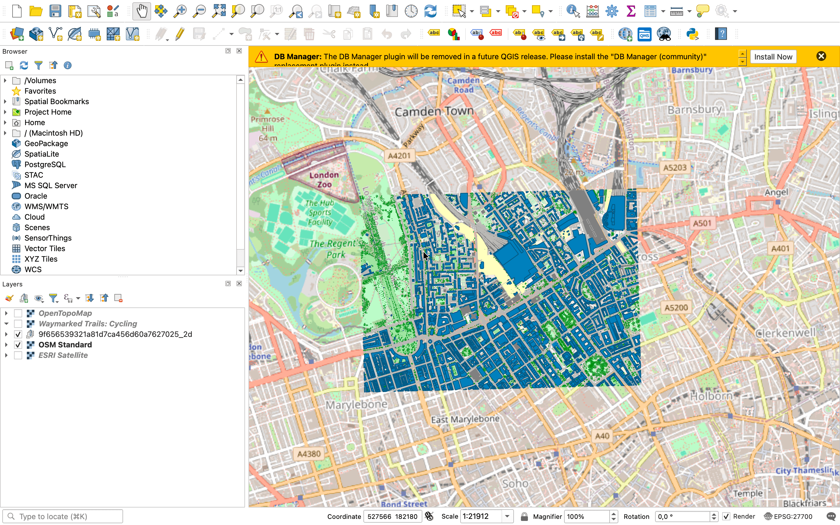
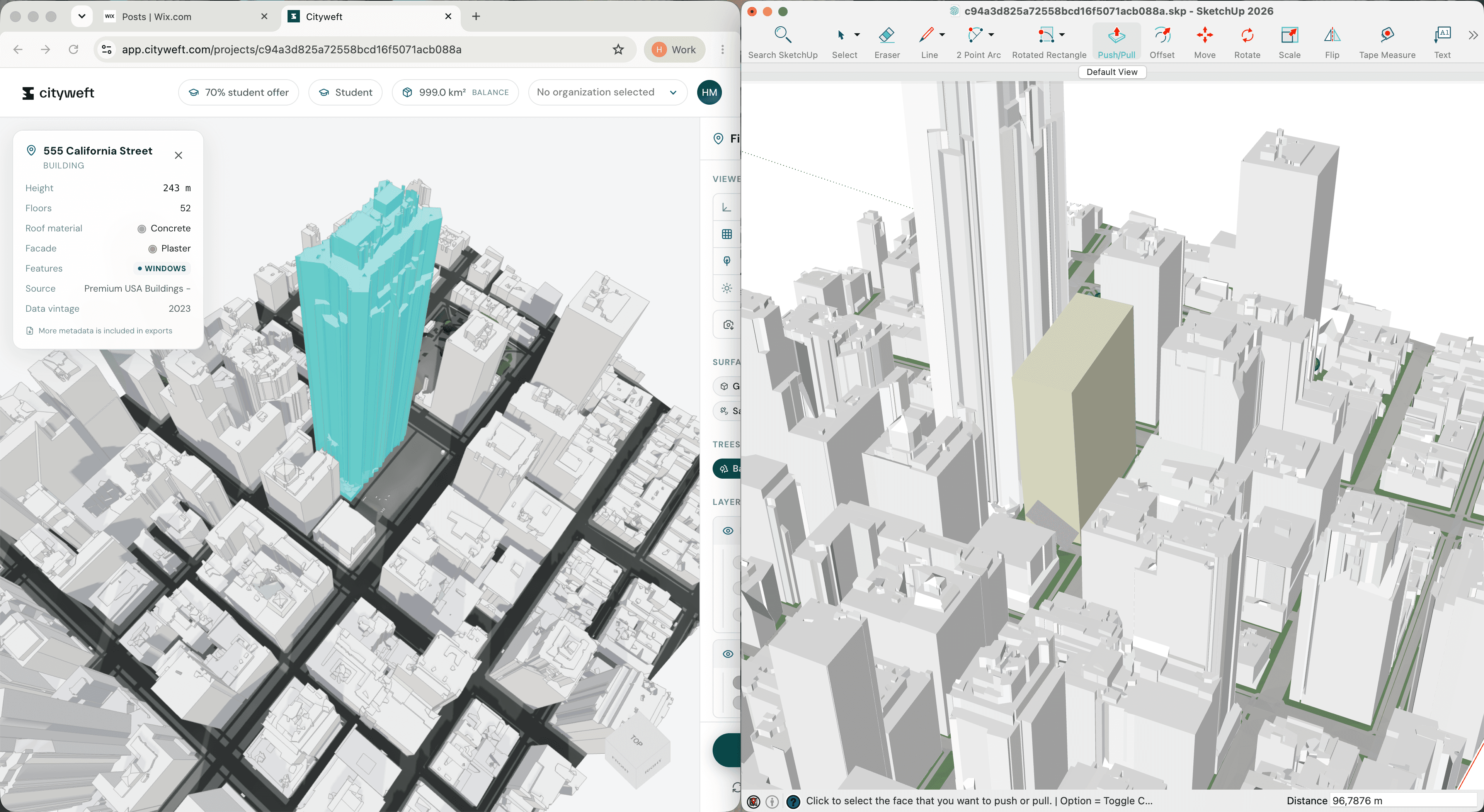
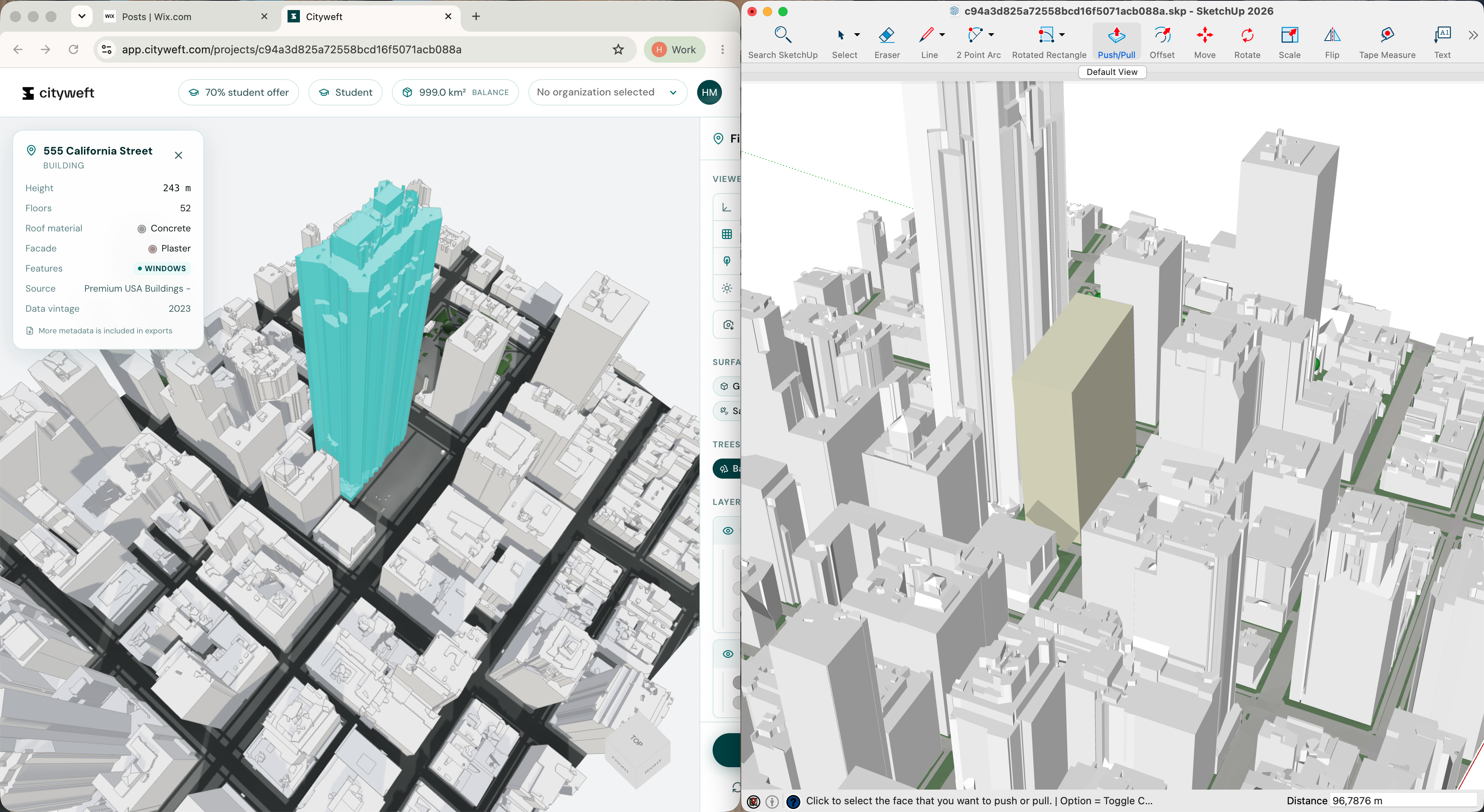
To get a better idea of how long this process would actually take, we set a timer while we ran through the nine sites. Our process was to first look at the site in Cityweft, using the free preview feature and then brought the most promising into Sketchup to take a more indepth look at the potential buildable area. We then measured this area and multiplied it by our guesstimation of potential building storeys, and noted this for each site before finally choosing the best contender to send over to our ‘client’.
Site 1: Adler Street, Seattle
First up, an empty plot on Adler Street, sitting close to the highway. It looked like a solid option in 2D.I selected the area in cityweft with a decent chunk of surrounding context, made sure topography was switched on, and hit preview.
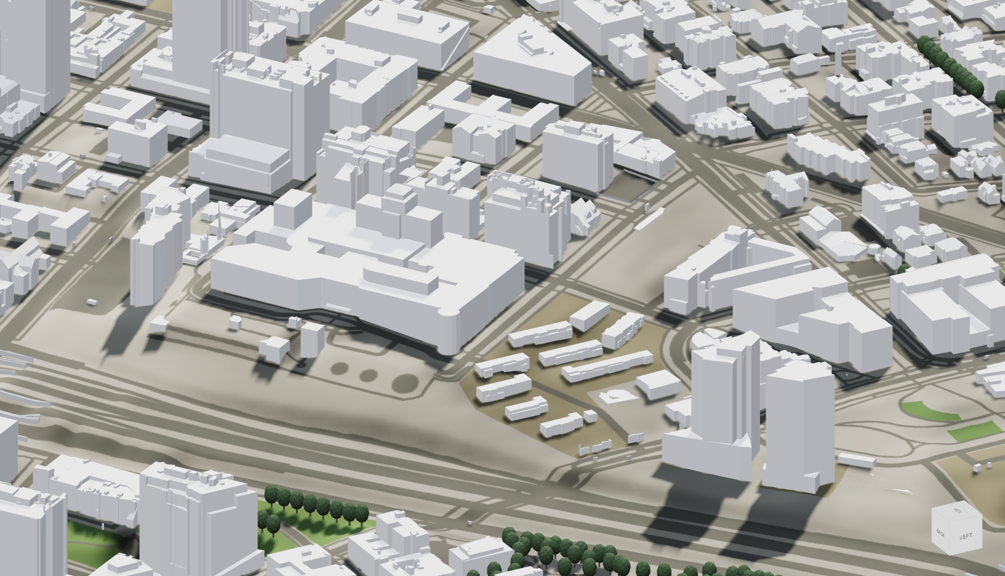
Once it loaded, we realised that there were already buildings on this site that hadn't made it onto Google Maps yet. The plot next to it was however was empty and nice and flat, so that's the one we brought into SketchUp.
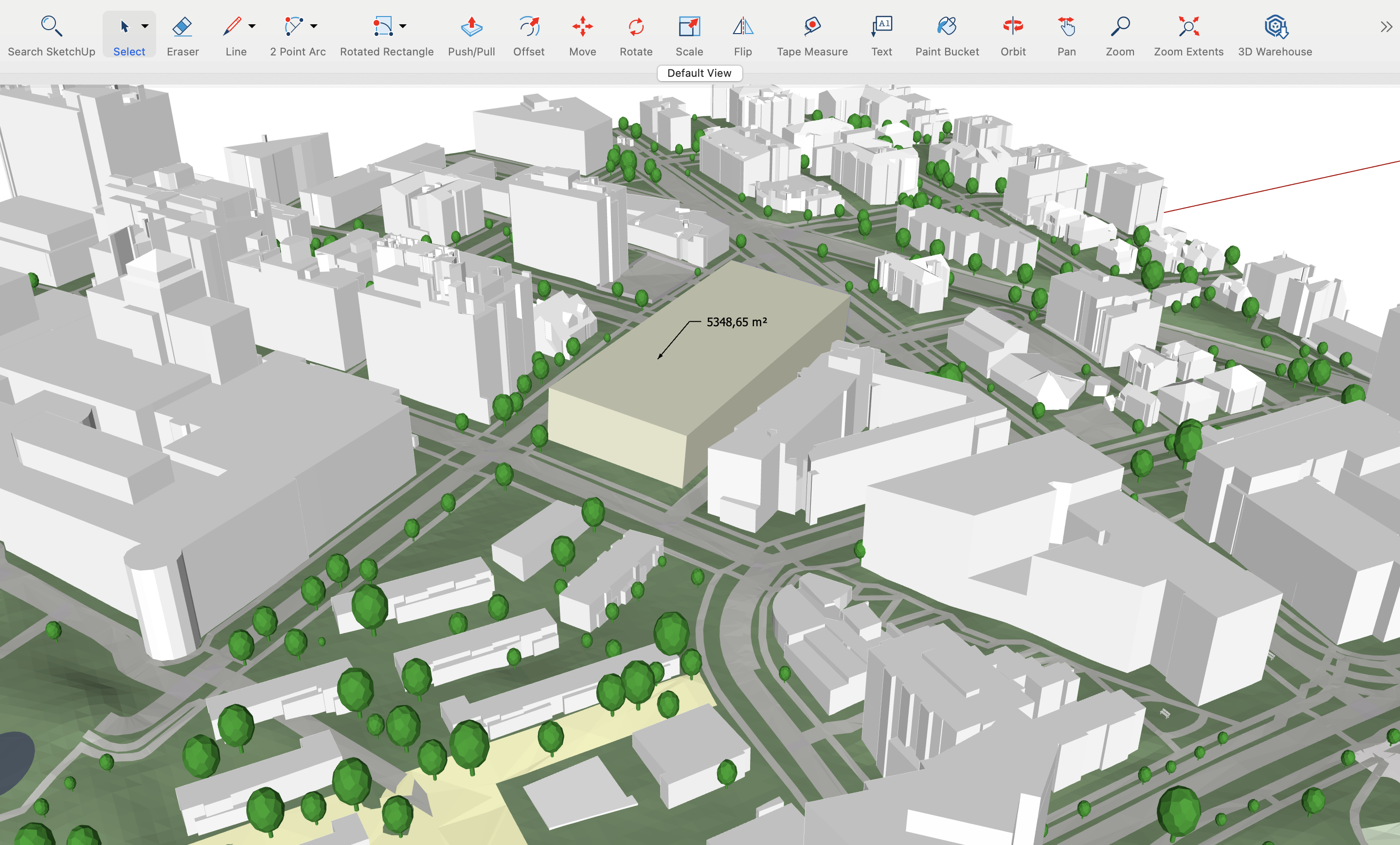
In SketchUp, the layers were grouped and organised exactly as they appeared in the platform, and every one of them was individually editable. As a rough buildable-area exercise, I drew a rectangle around the site and pulled it up to roughly the height of the surrounding buildings: about 5,300m² of area at 17m, so three to four storeys. I added this information to a spreadsheet and moved on to the next site.
Site 2: near the stadiums
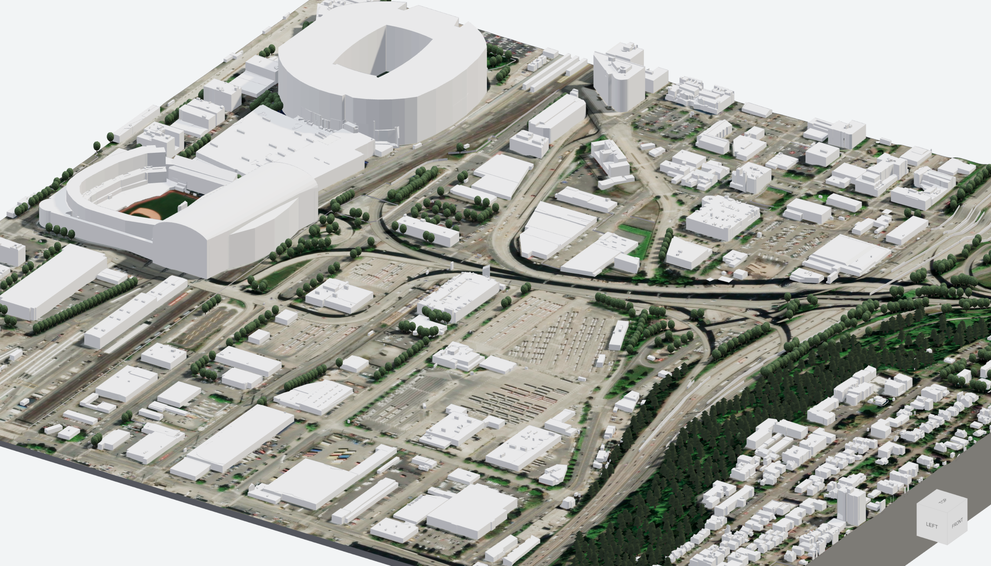
The second site sat on the other side of the highway, near Lumen Field and the T Mobile park. I suspected this one might be too industrial, but worth a look regardless since it seemed quite underdeveloped.
In plan view it looked like plenty of empty space. But when I switched on the satellite image a lot of that "empty" space turned out to be car parking, with any actually vacant land sitting right next to an industrial unit. This wouldn’t be suitable for a residential development, so I discarded this.
Site 3: heart of Seattle
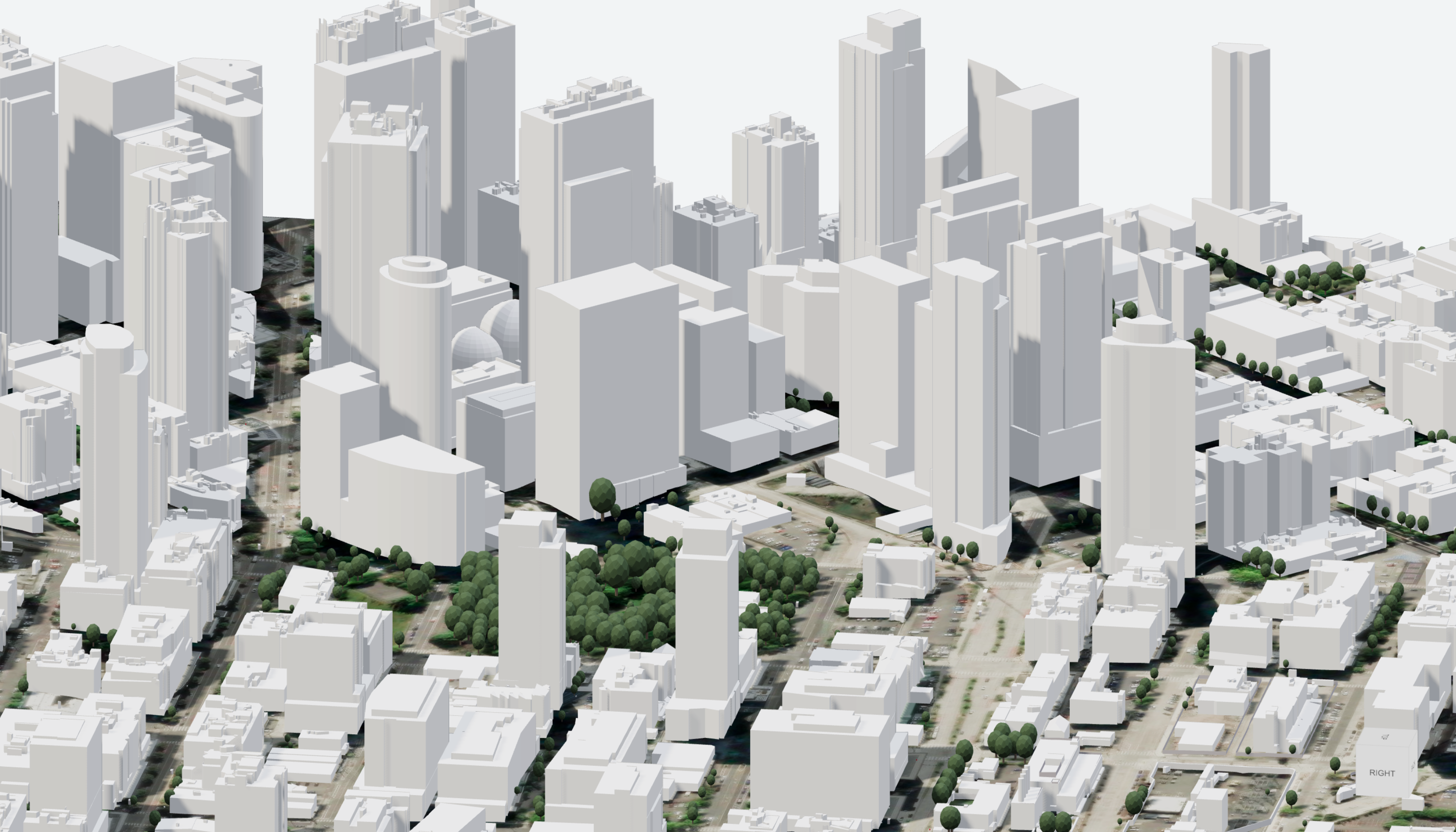
Our third site was a corner plot in central Seattle, with two small buildings scheduled for demolition. Our “client” had flagged this one as having strong potential for a higher-rise residential building.
This looked promising, so I took it straight into Sketchup. With tall buildings surrounding the site, I could reasonably estimate a larger building here too. I pulled the massing up to match the height of the neighbouring block and logged the numbers.
Site 4: First Hill
Our last Seattle site, in First Hill, had a few small buildings due for demolition, but it was a small plot surrounded by low-rise buildings. I could tell pretty quickly that there wasn't much buildable area on offer, so I left this one behind.
San Francisco: sites 5–9
The remaining five sites were all in San Francisco.
The fifth sat in a low-rise area but on a generously sized plot, so it was worth bringing into SketchUp. I measured up and logged the area.
The next one (6) turned out to have far more terrain change across it than we expected. The added challenge and cost of dealing with this kind of level change made it a non starter.
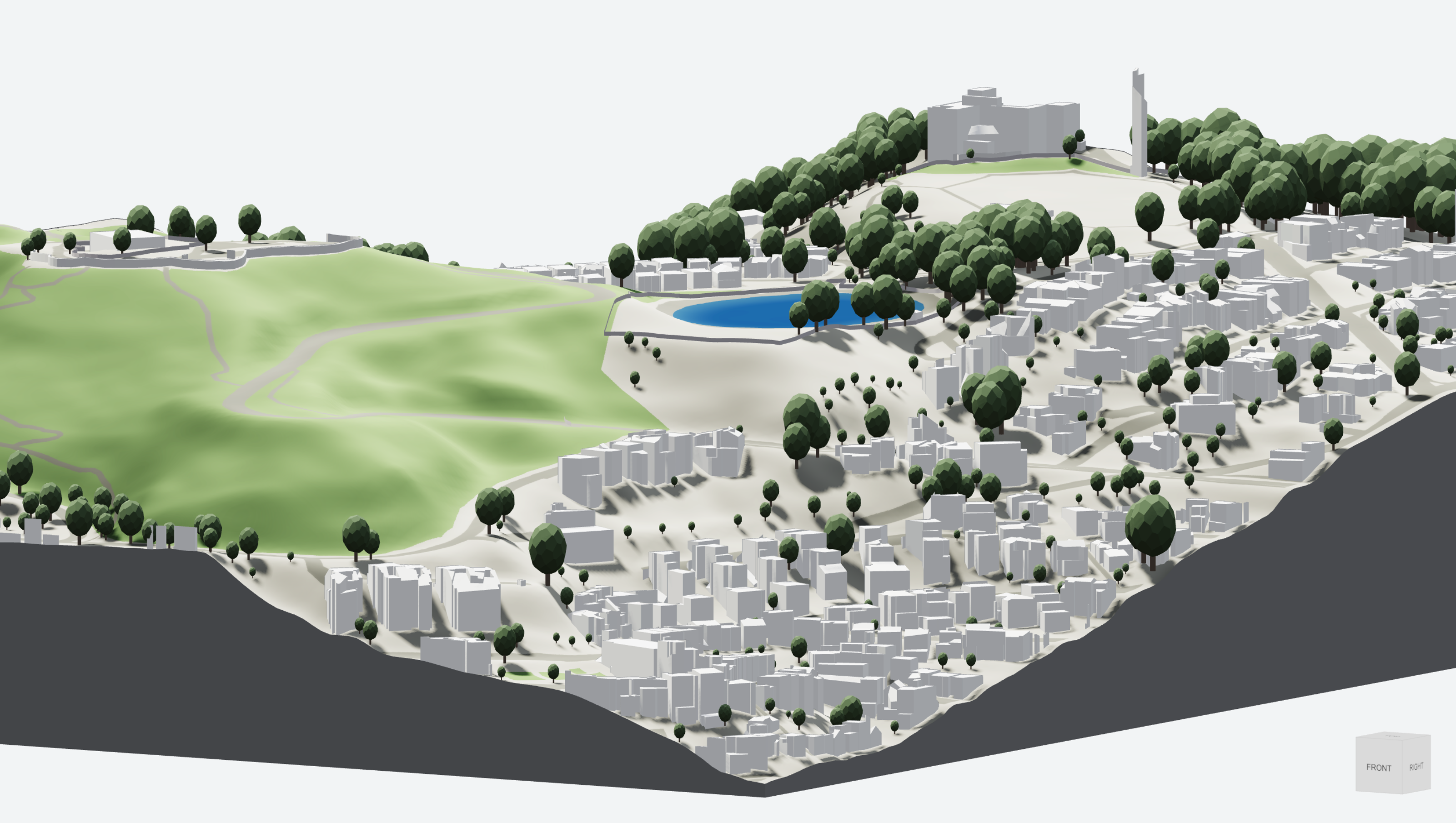
Then, of the three remaining sites, only one held up once we previewed them properly in 3D.
The Result
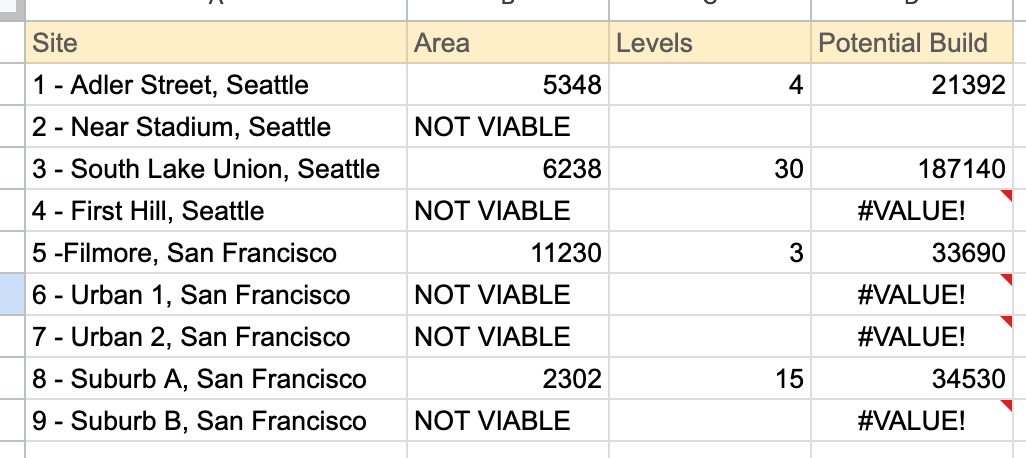
All of this took a grand total of 19 minutes! I then went back over to the spreadsheet to see what we'd learned. Five of the nine sites weren't viable at all, and of the ones that were, only site 3 had enough buildable area to work with for a 100,000m² development.
The takeaway
In under 20 minutes, we went from nine sites to one viable option and got a first look at massing before anything was passed back to the client. I wouldn’t have been able to do this effectively with a spreadsheet and a set of 2D plans.
Seeing the terrain, the neighbouring buildings, even the buildings Google Maps hasn't caught up with yet was what really helped with making the calls. Without it, I'd almost certainly have wasted time on two or three of these before figuring out they didn't work.
If you've got a stack of sites to run through yourself, go to cityweft.com and give it a go. We’ve also got a plugin for SketchUp, so you can be doing exactly this within a few minutes.
Follow us on LinkedIn and Instagram — we'll be posting the full cost breakdown of this exercise in the next few days. It's probably cheaper than you think.