
Your model, in its street.
Every layer still there.
Upload a Rhino, SketchUp, IFC, DXF, glTF or Revit model. It is placed in the real city with its names, layers, colours and materials, it replaces the building that stood on its plot, and when you export the same format you get your original file back, inside the city model. Your organisation's models, organised on one map, never lost.
Your upload, your scan and the city, in one model. Ready to export.
Everything on this page lives in the same Cityweft environment: the model you uploaded, the buildings reconstructed from your scan, and Cityweft Global around them. One project, one export, in the format your tool reads.
Exported together as
 Rhino
 Revit
 SketchUp
 IFC
 DXFand more
Thirteen formats, read for what they carry.

Rhino 3DM
Meshes, Breps and extrusions as render meshes, nested blocks, the layer tree with colours, materials and transparency, object names, user text, and the Earth Anchor Point.
SketchUp SKP
Groups, components, materials and tags, read as they are, and the geolocation when the file has one.
IFC 2x3, 4 and 4x3
Elements with their classes, surface styles and storeys, placed by the map conversion or the site's coordinates and true north.
DXF
Meshes, 3D faces, polyfaces and block inserts, layer and true colours, the drawing's units and geodata.

glTF, GLB, OBJ, STL, PLY, DAE, FBX, 3MF
Node names and colours, units from the file where it declares them, Cityweft's own extras when the file was exported from Cityweft.
Revit RVT
Converted to IFC by Autodesk Platform Services first, then read like an IFC: elements, categories and colours. A Revit export of a project that includes the model is built into your own file.
Up to 2 million triangles per model. Textures and companion files travel with the upload and are kept with it.
Add to My Data
An aerial LiDAR scan, a 3D model, or any file to pin on the map. We read what the files carry and ask only for what is missing.
Aerial scan
LiDAR from aircraft or drones
3D model or file
Models processed, other files pinned
Street scan
Vehicle or tripod
ComingDrop a 3D model or any file here or click to choose
Models — 3DM, SKP, IFC, DXF, glTF, OBJ, STL, FBX or 3MF with their textures, .bin or .mtl (up to 2 M triangles) — are processed and placed. Anything else — photos, PDFs, drawings — is pinned on the map.
Name
Uploading to Studio North — visible to everyone in the organisation.
Private to you and Studio North — no one else can access your data. Files are deleted together with the dataset.
Position and units
Placement
Model unit
Up axis
A 3dm EarthAnchorPoint, an IFC map conversion or DXF geodata places the model by itself; you can move or turn it on the map afterwards.
Three ways to the right spot. Seconds to move it.
My Data
harbour_pavilion_v3.3dm
Uploaded by a teammate — you can view it, use it in projects and download its files. The uploader and organisation admins can change or delete it.
Results
Buildings (components)
1
3DM file · 46,210 triangles
Parts
412
412 with their own colour · unit m · Z up
Footprint area
2,860 m²
EPSG:25832
Native export
3DM
the original file is embedded in these formats
3D model
The model as it was read from your file, with its parts and colours — the same geometry that goes into projects and exports.
Position
Placed from the file's own georeference (earthAnchor). Rotation 0.4° from north · 55.71024, 12.59612 · sits on the terrain
Notes
- No base elevation given — the model is placed on the terrain at its centroid in each project.
- Placed from the file's own georeference (earthAnchor).
My Data
Inside your scans, your buildings, terrain and trees replace Cityweft's.
harbour_pavilion_v3.3dm
covers ~9% · 1 building
From the file
A Rhino Earth Anchor Point, an IFC map conversion, DXF geodata or Cityweft's glTF extras place the model by themselves.
By a coordinate system
Name the projected system the file's coordinates are in, a national grid or a UTM zone, and the x and y are used as they are. No rotation, nothing to drag.
On the map
The model's real plan outline on the imagery: click where it belongs, drag it, turn it with a ring, snap to 90°. Exact values if you have them.
Heights are decided per project, not at upload: keep the file's own heights, set the model on the terrain, or give the ground level above sea level, the ±0.00 of the plans. Moving or turning a placed model re-runs only its placement, in seconds.
In replace mode the model takes the place of the Cityweft buildings under its footprint. It is never cut at the project boundary: your models are placed whole.
A SketchUp tower, an IFC condo and a Rhino block. One export.
Three uploads from three tools, each placed where it belongs and kept whole, exported together with the city around them.
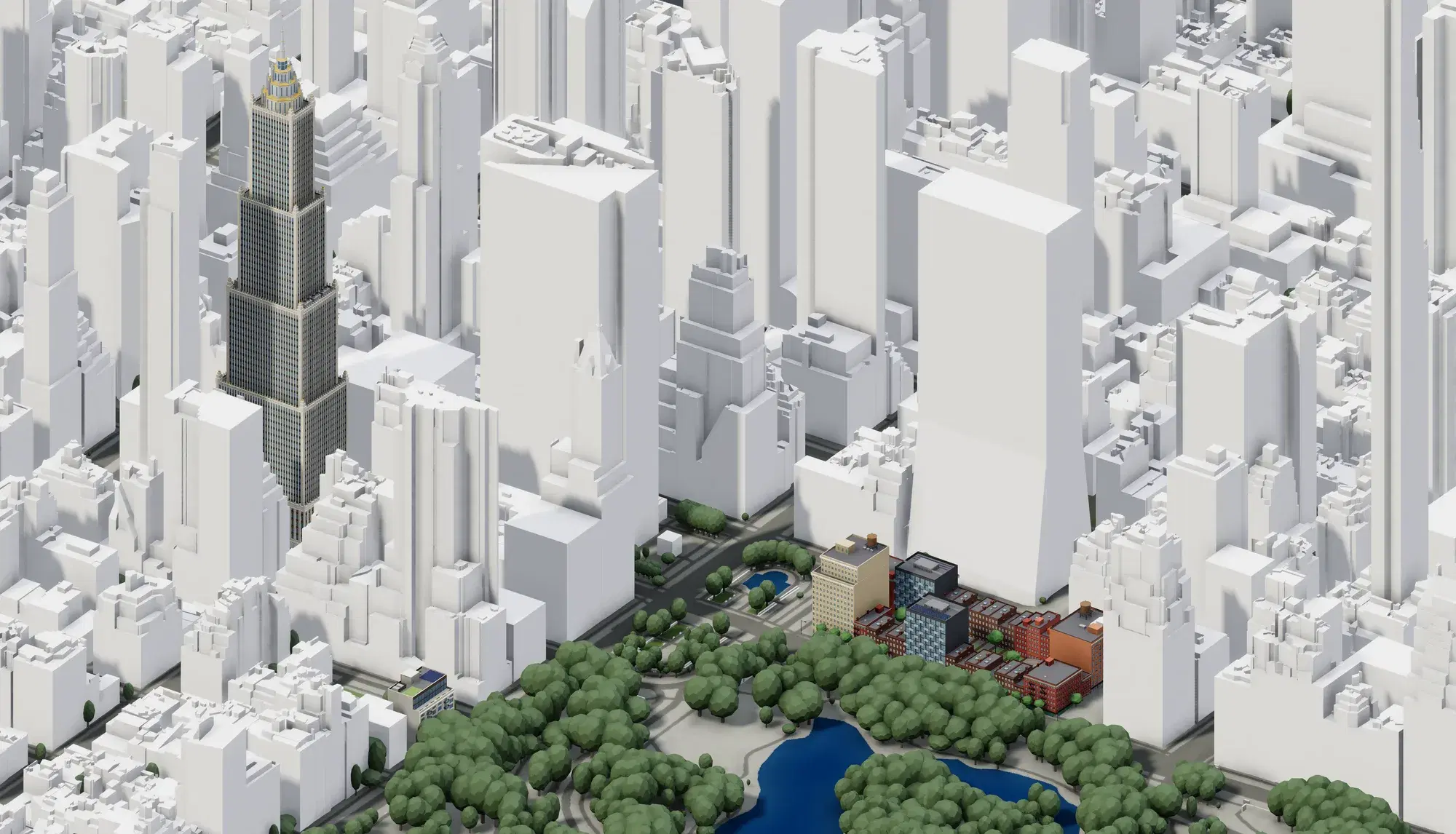
- SketchUp Art Deco tower
- IFC 12-storey condo
- Rhino 34-building block
Export the same format, get your file back.
Your upload is stored byte for byte. When a project that includes it is exported in the same format family, the original file is embedded as itself, through the library the exporter writes with. Every other format receives a structured copy: the geometry with its part names, layers and flat colours.
Export Model
Configure your export and download.
All formats

Rhino
Native .3dm — a layered model with NURBS terrain and georeferencing.
Features
Settings
Centered on the site, no map grid. Choose one to line the file up with surveys, GIS data and your other exports.
Export Model
Configure your export and download.
All formats

SketchUp
Native .skp — tag-organised model with georeferencing.
Features
Settings
Set automatically — the model carries its real geographic location, so SketchUp's location-based features line up.
Rhino 3DM
Exported as the same format
Your objects as they are: Breps, NURBS, extrusions, meshes and curves, the layer tree with its colours, materials and user text, under a layer named after your dataset.
Exported as any other format
Mesh copy with names, layers and colours
SketchUp SKP
Exported as the same format
Your file as a component: groups, components, materials, textures and tags intact.
Exported as any other format
Mesh copy with names, tags and colours
IFC
Exported as the same format
Your elements appended under a building named after your dataset, with their classes, styles and property sets.
Exported as any other format
Mesh copy with names, storeys and colours
DXF
Exported as the same format
Your drawing as a block, entities, layers and nested blocks included.
Exported as any other format
Mesh copy with names, layers and colours
glTF, GLB, OBJ, STL, PLY, DAE
Exported as the same format
Your nodes added to the exported scene, hierarchy and materials kept across the family.
Exported as any other format
Mesh copy with names and colours
Revit RVT
Exported as the same format
The Cityweft context is built into your own Revit file: every element, family, view and sheet stays as it is.
Exported as any other format
Mesh copy with names, categories and colours
FBX, 3MF
Exported as the same format
Mesh copy with names and colours
Exported as any other format
Mesh copy with names and colours
Not lost in a folder. On the map, for everyone.
Uploads made with an organisation active belong to the organisation. Every member sees them on the map, uses them in projects, exports with them and downloads the originals. The uploader and the organisation's admins change, re-run or delete them. Exports made by teammates embed the organisation's original files natively, and a note on each dataset tells everyone where the file comes from and what to watch out for.
- Every model of the firm, on one map, searchable
- Private to the workspace; nobody outside can see or use it
- Pooled storage on Small Business and Business
My Data
16 datasets · 2.1 GB · ready for any project that touches them
Harbour district survey
2.71 km² · 34 pts/m² · 512 MB · added 2 Nov
harbour_pavilion_v3.3dm
2,860 m² · 46k triangles · 9 MB · added 2 Nov
Alfama rooftops, drone flight
0.42 km² · 61 pts/m² · 198 MB · added 30 Oct
waterfront_tower_option_b.skp
1,514 m² · 41k triangles · 1 MB · added 30 Oct
Campus library, IFC4
4,120 m² · 96k triangles · 18 MB · added 28 Oct
Marina competition site
1.1 km² · 46 pts/m² · 640 MB · added 29 Oct
stadium_roof_study.fbx
24,600 m² · 310k triangles · 21 MB · added 27 Oct
Site survey report, May 2026
3 files · 14 MB · added 27 Oct
What arrives on the other side.
Rhino
Your 3DM comes back under a layer named after your dataset, with its own layer tree, colours, materials and user text, inside the Cityweft layers of the city around it.
Revit
Upload the RVT, and the export is built into that very file by Revit running in the cloud: the city arrives as masses, a Toposolid and site elements next to your own work.
SketchUp
Your SKP is loaded as a component with its groups, materials and tags, placed on its own tag next to the Cityweft groups.
IFC
Your elements are appended under a building named after your dataset, with their property sets, next to the city's proxies, slabs and geographic elements.
What people upload, and why.
A design in its real context
The Rhino or SketchUp model on its plot, the neighbourhood around it at country-model quality, exported together for the next review.
Rhino to Revit, without rebuilding
The concept lives in Rhino, the documentation in Revit. Upload the 3DM once, export the project as RVT or IFC, and the context comes with it.
The firm's model library
Every project model, placed where it was built, visible to the whole organisation, re-exportable in a format the next tool reads.
A survey DXF in the national grid
A surveyor's drawing in the local coordinate system is placed exactly by naming that system, no dragging and no rotation.
Options side by side
Massing variants uploaded as separate models, each replacing the building on the plot, compared on the same map.
Included on every plan. Sized by the plan.
| Pay-as-you-go | Professional | Small Business | Business | |
|---|---|---|---|---|
| Storage for your uploads | 5 GB | 50 GB | 250 GB | 1 TB |
| Point cloud processed per month | 1 GB | 15 GB | 40 GB | 60 GB, then €3 per GB |
| Uploads | 5 in total | Unlimited | Unlimited | Unlimited |
| Largest file | 1 GB | 10 GB | 10 GB | 10 GB |
| Export projects that use your data | Preview only | Unlimited | Unlimited | Unlimited |
| Allowances | Per user | Per user | Pooled across the organisation | Pooled across the organisation |
- A scan counts its file size when a run starts. Models and pinned files never count as processing.
- In replace mode, the part of a project your own scan covers is not counted against the km² allowance. A project entirely inside your scan exports free.
- Free accounts upload and preview. Every subscription exports without limit.
Bring your first scan or model.
Upload once. It is on the map with every project that touches it, and in every export you make from there.